 A core part of any good fleet telematics solution, geofences have a variety of uses, but what is a geofence and how best to use them?
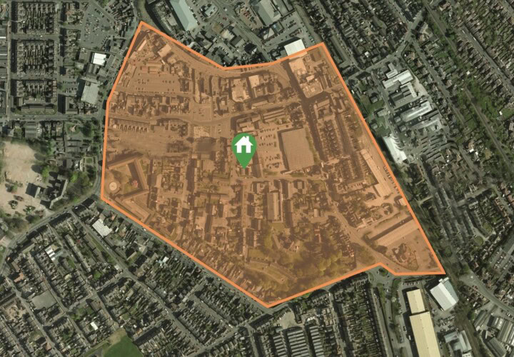
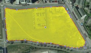
Well, a geofence is a virtual geographic boundary, usually defined by GPS, that enables software solutions to trigger an action when a device being tracking breaches – either in or out – that boundary. Geofences can also be defined by RFID technology.
When used to good effect, geofences can deliver a range of efficiency, utilisation and safety benefits.
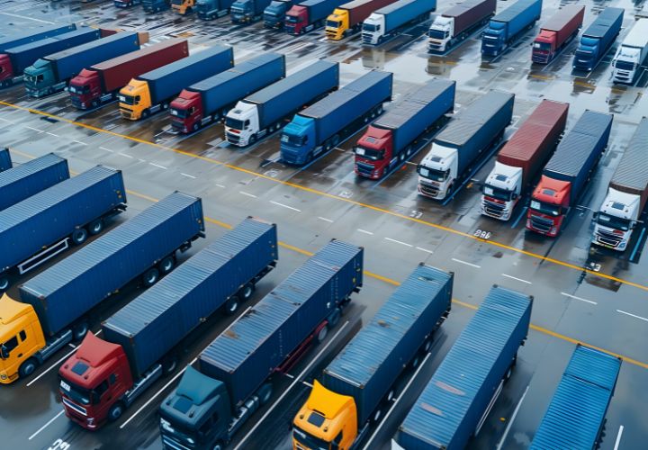
That’s all well and good, but what are the practical examples of how this technology can help with vehicle tracking and fleet management? We’ve outlined below 15 use cases for geofences.
Security
Receive an alert when an asset leaves an area
Perhaps a machine, vehicle or trailer should always be present in a certain location out of hours, or during a particular time of the year. If that asset leaves the area when it shouldn’t, your fleet management team can be alerted and investigate the movement.
Monitor a highly valuable load or machine
When moving highly valuable items, you may wish to know when a vehicle deviates from its agreed route. By setting up a geofence which encompasses that route, you can be alerted if the vehicle breaches the boundary of that route.
Utilisation
Track the number of visits to a location
Understand how many times a particular asset attends a particular location, to monitor the use of that asset and it’s ROI. By comparing utilisation data across your fleet assets, you may gain insights that inform better decision making, for example by understanding that a certain type of vehicle is being used more than others.
Monitor use of assets
Further to the point above, geofences allow fleet management to understand how, when and the frequency of asset use, whether that be a vehicle on the road or a machine asset working in a fixed location. Utilisation data can be reviewed when it occurs within a geofence for a more detailed view.
Proximity to another asset
Fleet managers may wish to understand and be alerted when an asset nears another. By setting up a geofence around a maintenance site for example, fleet management can be alerted when a vehicles passes close by and check whether any maintenance could be carried out, without the need for that asset to return to base specifically for that maintenance at another time.
Compliance & Safety
Proactively managing traffic restrictions
In many urban environments around the world, the use of certain vehicles are restricted to certain times of day, or certain vehicles may simply be prohibited altogether. Geofences can be used by setting up a boundary around the urban environment in question, with fleet managers being alerted if a vehicle enters into the area when it shouldn’t.
Ensuring vehicles avoid danger spots
The fleet team may have identified a number of danger spots they wish to avoid. Geofences can be set up around these black spots, with the management team alerted if a vehicle approaches. This can then prompt corrective action, with a vehicle re-routed or a driver warned of the upcoming danger.
Vehicle restrictions on routes
Whether due to restrictions on the road or simply experience informing fleet management of potential issues, geofences can be used to ensure vehicles of certain sizes and make-ups avoid routes where restrictions apply. Typically route optimisation engines would ensure vehicles travel appropriate routes, however geofences could be set-up around low bridges for example, to ensure high vehicles avoid them where the suggested route has not been followed.
Efficiency
Measuring turnaround times
By using geofences to monitor when a vehicle or asset enters and leaves a location, management can monitor turnaround times and identify poor performing locations. This is especially useful in transport and logistics, where a vehicle arrives and needs to unload quickly before setting off for its next destination.
Monitor time spent at a location
Similarly, geofences allow for reporting on the average time spend at a location. In a field service setting, such insights might reveal that a particular location or area sees engineers spend a higher than average time on-site.
Alert locations of an incoming arrival
With geofences set-up around a customer site for example, the customer can be alerted when a vehicle or asset is a certain distance away. This ensures the site is ready to receive the vehicle and asset, rather than it arriving unexpectedly causing delays and confusion.
Average time spent travelling between locations
Monitor how long vehicles take to get from A to B, understanding the average time taken and taking action on exceptions. Perhaps a driver is consistently taking longer to travel between two destinations? By using geofences to understand this, exceptions can be identified and investigated, for example stopping that driver taking a longer route he or she believes to be faster – in error!
Billing & Tracking
Monitor time on site to aid billing accuracy
Particularly useful in field service or machine hire scenarios, geofences provide evidence and tracking of the time spent at a location. This information can feed directly into billing for reduced administration and faster payments.
Monitor after hour use
In some cases, there may be restrictions on use of a vehicle or asset after normal business hours. Geofences can be used to monitor such use.
Customer Experience
Respond to customer demand
The ability to react to demand is key in delivering a positive customer experience. Geofences can be set up around a region or regions, to allow fleet management to understand which assets are in the area and therefore with additional information on status and availability, direct those assets to meet the demand of customers.
——
In summary, geofences can play a key part in terms of how you manage your fleet. With some simple applications, geofences can enhance security, improve utilisation, increase efficiency and support compliance.
Microlise vehicle tracking solutions offer geofence functionality as standard and our team will help you understand how they can be used to deliver value to your operation.